|
| Was the high tide in Saxon times 5 metres higher ? - Pevensey |
|---|
Table of Contents
|
|---|
|
A logical discussion of why the high tide level in early Anglo Saxon times could have been 5 metres higher than today ▲
|
|---|
This page is designed to show why I believe that the sea level was 4 to 5 metres higher than today, in about 450AD
(early Anglo Saxon times)
Lets take an area I know - the Pevensey Levels in Sussex - click here if you would like to see a similar argument
applied to the Wash.
So we will start by looking at the Saxon place names which refer to islands these places are all derived from the Saxon
word æg meaning an island, which has been shown to refer to modern place names starting in eg, ending in ay, et,
ey, ly, ney, sea, sey, ye , is, or contain the snippet eye or island.
So lets take a look at modern Pevensey and see if we can make it and the surrounding island villages into islands by
raising the sea level. The following images are derived from Open Streetmap with the sea level overlays provided by Alex
Tingle from http://flood.firetree.net.
|
This map shows the current sea level ▲
|
|---|
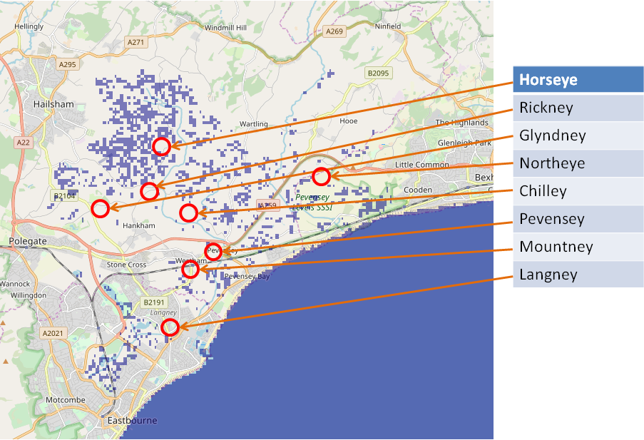
This map is derived from flood.firetree.net and shows the current sea levels in the Pevensey bay in East Sussex,
England.
|
This map shows the sea level raised by 1 metre ▲
|
|---|
This map is derived from flood.firetree.net and shows the effect of a 1 metre rise in sea levels in the Pevensey bay
in East Sussex, England.
|
This map shows the sea level raised by 2 metre ▲
|
|---|
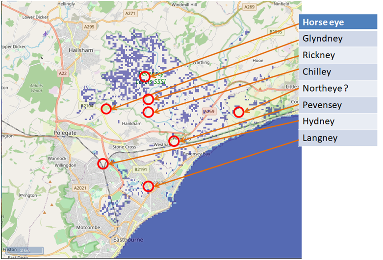
This map is derived from flood.firetree.net and shows the effect of a 2 metre rise in sea levels in the Pevensey bay
in East Sussex, England.
We don't see any islands at the moment, but there are some interesting possible islands, such as horse eye.
|
This map shows the sea level raised by 3 metre ▲
|
|---|
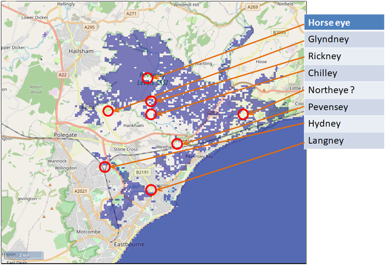
This map is derived from flood.firetree.net and shows the effect of a 3 metre rise in sea levels in the Pevensey bay
in East Sussex, England.
This is starting to get interesting, there are islands appearing, but Rickney and Chilley look underwater, however
the resolution of the Nasa Data is not fine enough to show the smaller islands.
|
This map shows the sea level raised by 4 metre ▲
|
|---|
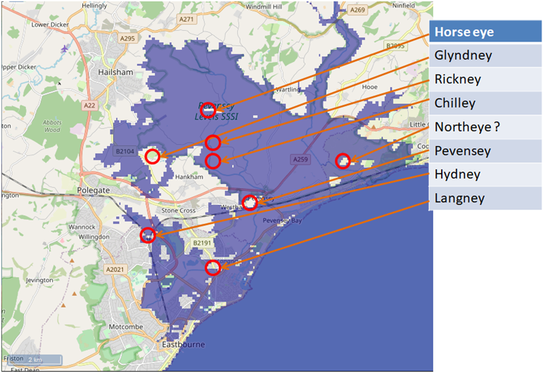
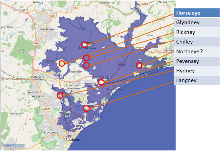
This map is derived from flood.firetree.net and shows the effect of a 4 metre rise in sea levels in the Pevensey bay
in East Sussex, England.
Langney is now an island along with Glyndney, so we are getting somewhere, but Pevensey is not quite an island.
|
This map shows the sea level raised by 5 metre ▲
|
|---|
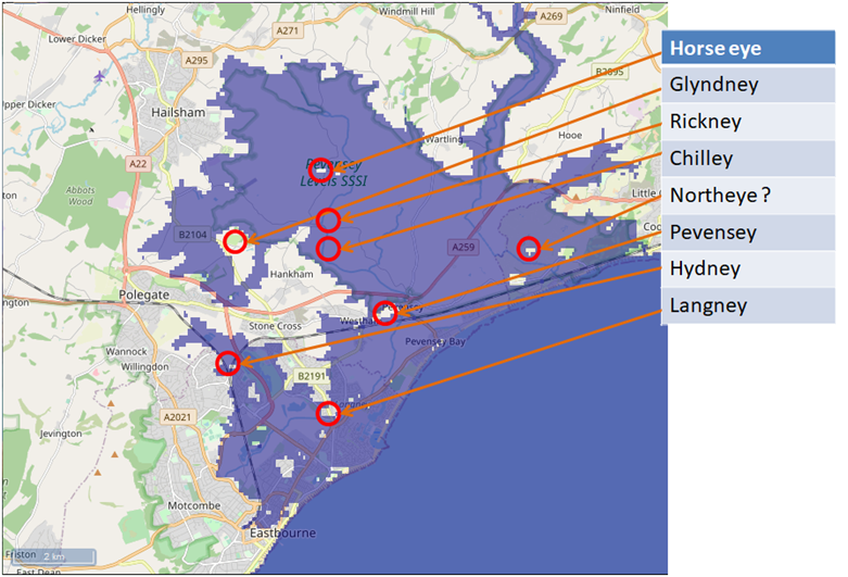
This map is derived from flood.firetree.net and shows the effect of a 5 metre rise in sea levels in the Pevensey bay
in East Sussex, England.
At last Pevensey is an island as are the other settlements ending in ay.
|
Conclusion(possibly) ▲
|
|---|
The Saxon definition of an æg would appear to mean a piece of land that wasn’t flooded at the highest high tide
or that the sea was about 4.5 metres higher than today.
Modern sea defences and shingle banks have a tendancy to hide the actual sea level.
You may not be convinced from a small example in an out of the way spot in Sussex, but click here to see the same logic
applied to the Wash which is an area between Norfolk and Lincolnshire.
|